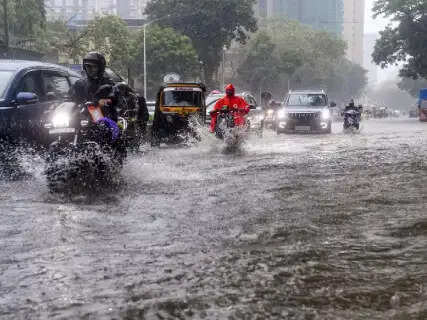
A highly potent meteorological convergence involving a deep low-pressure atmospheric area positioned over West Bengal and adjacent northern Jharkhand has violently reactivated monsoon dynamics across Chhattisgarh. The India Meteorological Department (IMD) has issued an urgent public safety advisory and placed central and northern districts under a strict 48-hour weather watch. The intense cyclonic circulation is continuously pumping massive oceanic moisture into the region, resulting in widespread light to moderate precipitation alongside severe localized cloudbursts. The state administration has mobilized disaster response teams to handle structural challenges and protect citizens in flood-prone lowlands.Fatal Lightning Strikes In Surguja And Sudden Reservoir Breaches In Janjgir-ChampaThe rapid intensification of thunderclouds has yielded tragic environmental consequences in the northern tribal belts. In rural Surguja, a severe cloud-to-ground lightning strike scorched four young children playing outdoors, resulting in the immediate death of two, while two brothers are currently undergoing critical medical treatment. Concurrently, the structural integrity of localized water infrastructure collapsed under extreme hydraulic pressure, causing a major portion of the Karra Nala reservoir in Akaltara, Janjgir-Champa district, to wash away. Local administrative teams executed a rapid midnight evacuation, successfully relocating 125 endangered residents to secure government relief camps.National Highway 49 Flooded: Lilagar River Bridges Overflow Forcing Strategic ClosuresSevere regional waterlogging has heavily disrupted state transportation networks, particularly along National Highway 49 in the Bilaspur division. Flash floods have caused muddy waters to rise four to five feet above the main highway asphalt, stranding commercial transport vehicles and passenger buses. In the vulnerable Kotmisonaar sector, local police forces have established strict barricades and completely halted vehicular movement across the primary Lilagar River bridge due to dangerous overflow levels. District collectors are continuously assessing local river gauges to determine when structural corridors can safely reopen to public transit.Urban Impact In Raipur: Cloudy Skies, Persistent Thunderstorms, and Subdued TemperaturesThe capital city of Raipur is experiencing a significant shift in environmental conditions, with local meteorologists predicting persistent overcast skies and active lightning grids over the next 24 hours. The sudden influx of moisture-laden northern winds has lowered seasonal tracking temperatures, with the city's maximum daytime reading hovering comfortably around 28 degrees Celsius, while nighttime minimum limits sit at a cool 24 degrees Celsius. Municipal corporations have cleared central drainage channels to minimize urban water stagnation during subsequent downpours.Evaluating The Macro Rainfall Data: Analyzing The Current Seasonal Deficit Across Key DivisionsDespite the current heavy downpours, official IMD statistical records indicate that the cumulative monsoon volume since June 1 remains approximately 25 percent lower than traditional historical benchmarks. Chhattisgarh documented an average precipitation of 17.7 mm on Saturday, bringing the total seasonal collection to 307.2 mm. This represents 81.8 percent of the decadal average of 375.4 mm tracked over the last ten years. Regionally, the Bilaspur division leads the state's cumulative water tallies, with Sarangarh-Bilaigarh logging a substantial 525.4 mm, closely followed by Janjgir-Champa at 441.5 mm and Bilaspur city recording a high daily value of 58.6 mm. In the southern Bastar division, Dantewada leads regional charts with 405.5 mm of rain, while Balrampur tops the Surguja division at 337.5 mm.
Around the web